It was supposed to be a three-peak day, two of them being gimmes that shouldn't take too many minutes each. It ended as only a two-peak day but at least that included the bigger one. Not that it was that big of a one. So, Black Mountain Peak, Borel Hill, and Windy Hill. On the approach to Black Mountain, driving up Page Mill, my gas light came on. It wasn't exactly the wilderness but the nearest gas station was in the other direction, back down into the valley. In the spirit of adventure, I decided to press on and find gas after.
The Black Mountain parking lot is fuller than I would have expected on a weekday morning. It turned out to be a group of geriatrics who I passed going opposite directions as I left the parking lot.
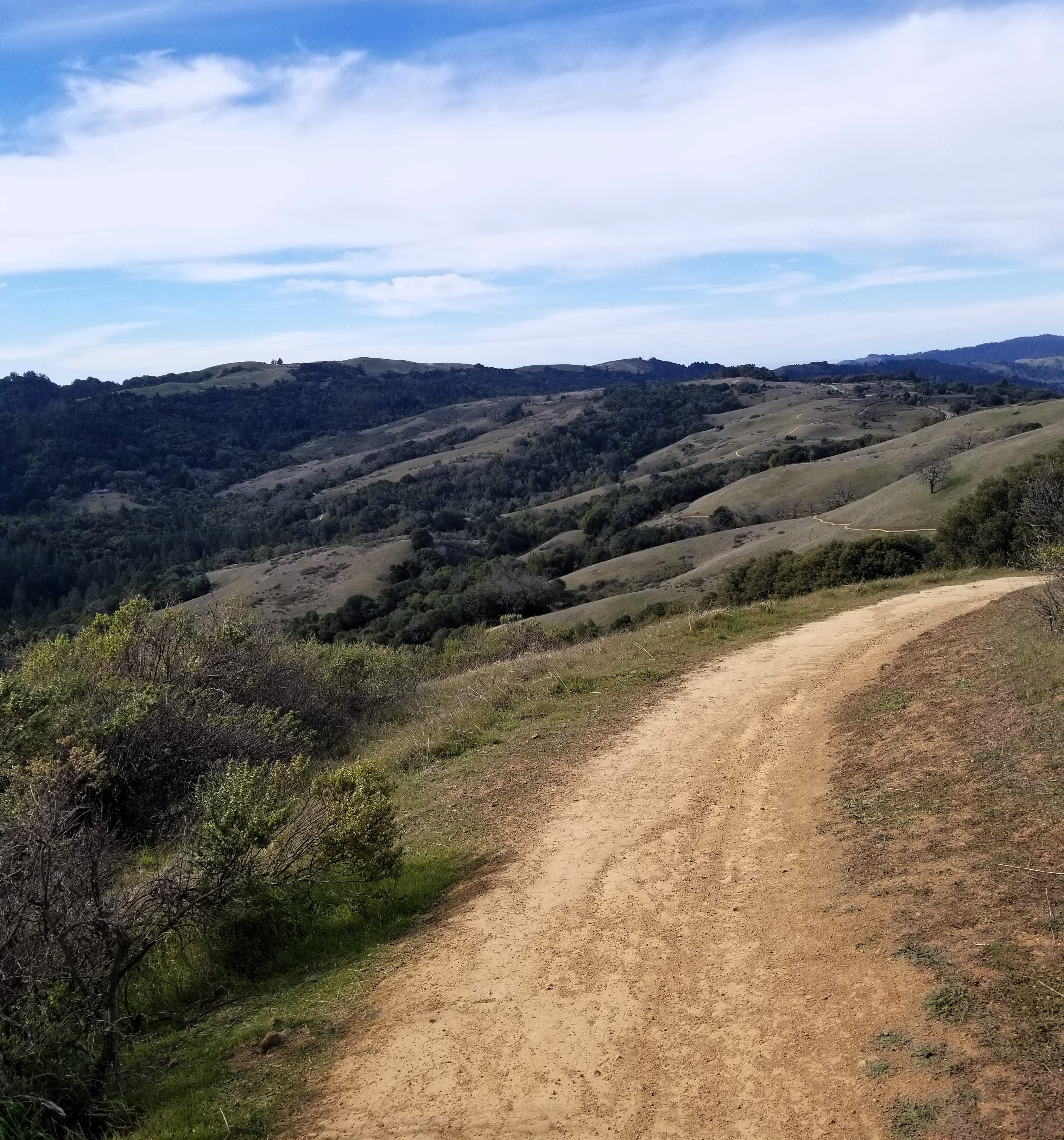
There are several possible routes braiding up to the peak. I started with a brief single-track feeder trail taking me to the Canyon Trail, a heavily shaded fire road beside a stream that I remembered as a long, fun downhill from a mountain bike ride a few years before. I’m on Canyon for only a short time before heading up the Bella Vista trail.
Bella Vista starts steep and then milds out to contour around the hillside up and over spurs and dropping down into little valleys. The majority of the hillsides are clear, tan grasslands. I wonder if they're naturally grasslands or if they're what remains after previous years of logging. The majority of the bigger trees still extant seem to be, by my inexpert eye, oak. In the brief valleys that cut into the hillside are rafts of thick vegetation that seem like they’re crowding down toward the meager supply of water in the ravine.
On the way up.
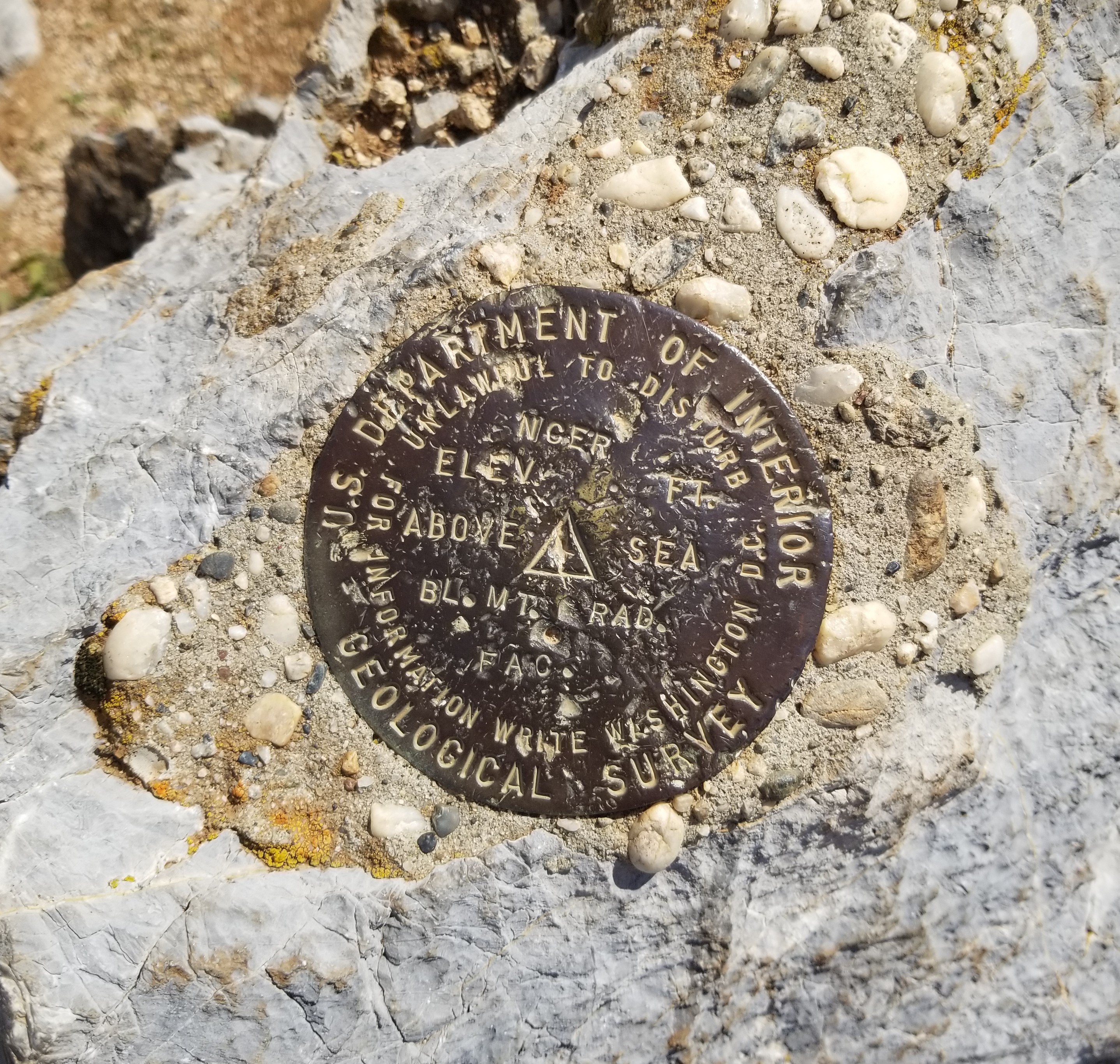
The actual, scientific, fer reals peak top.
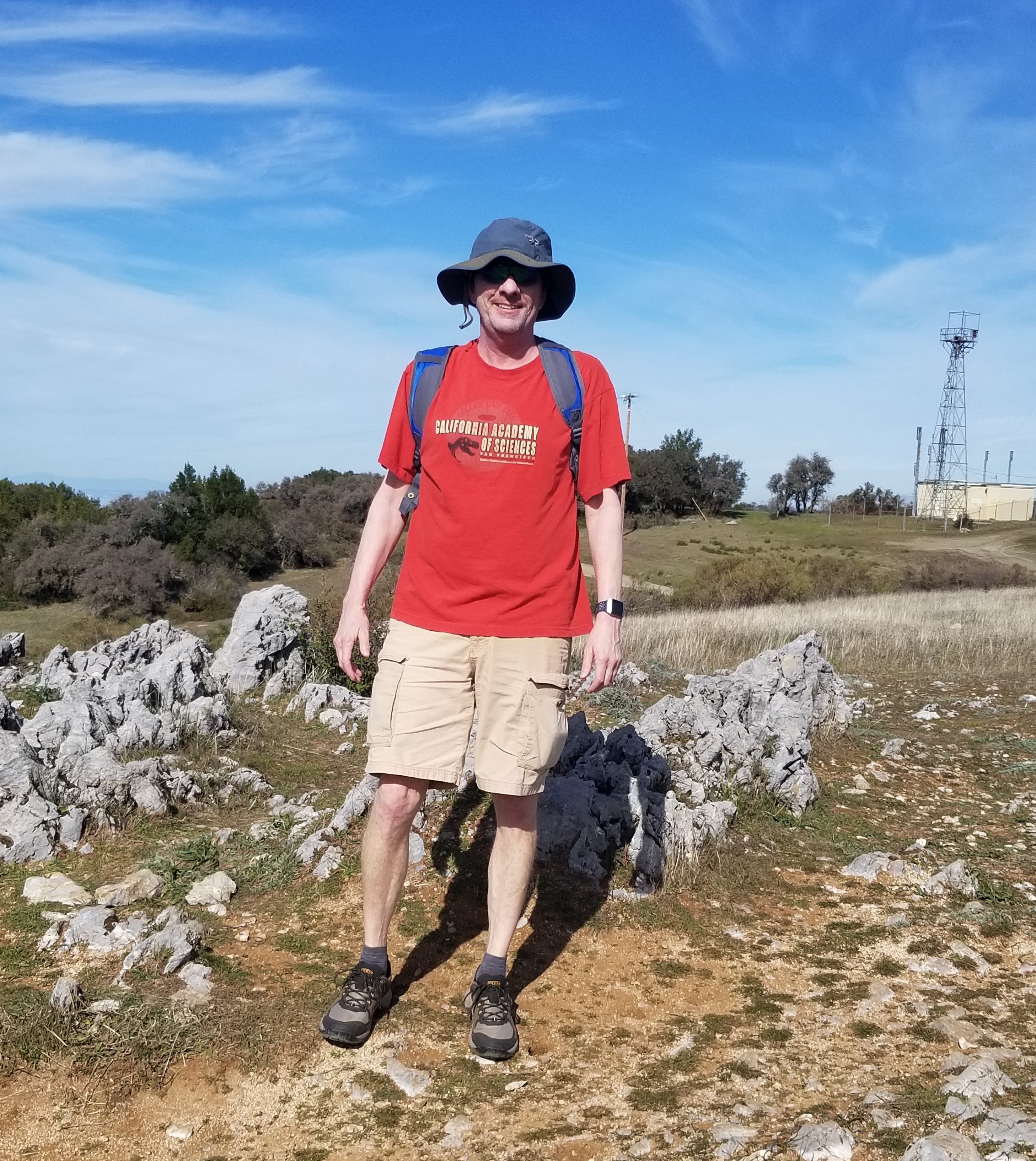
"'Cuz every girl crazy 'bout a sharp dressed man."
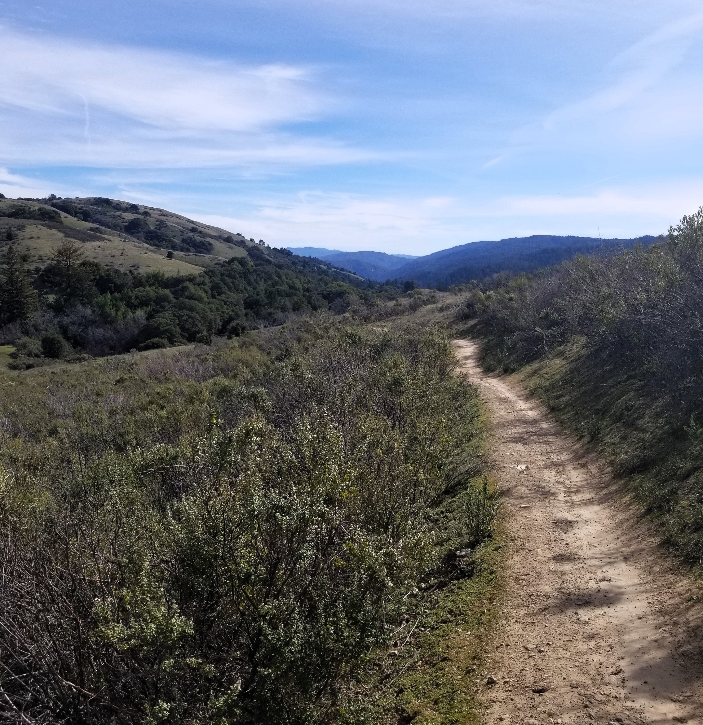
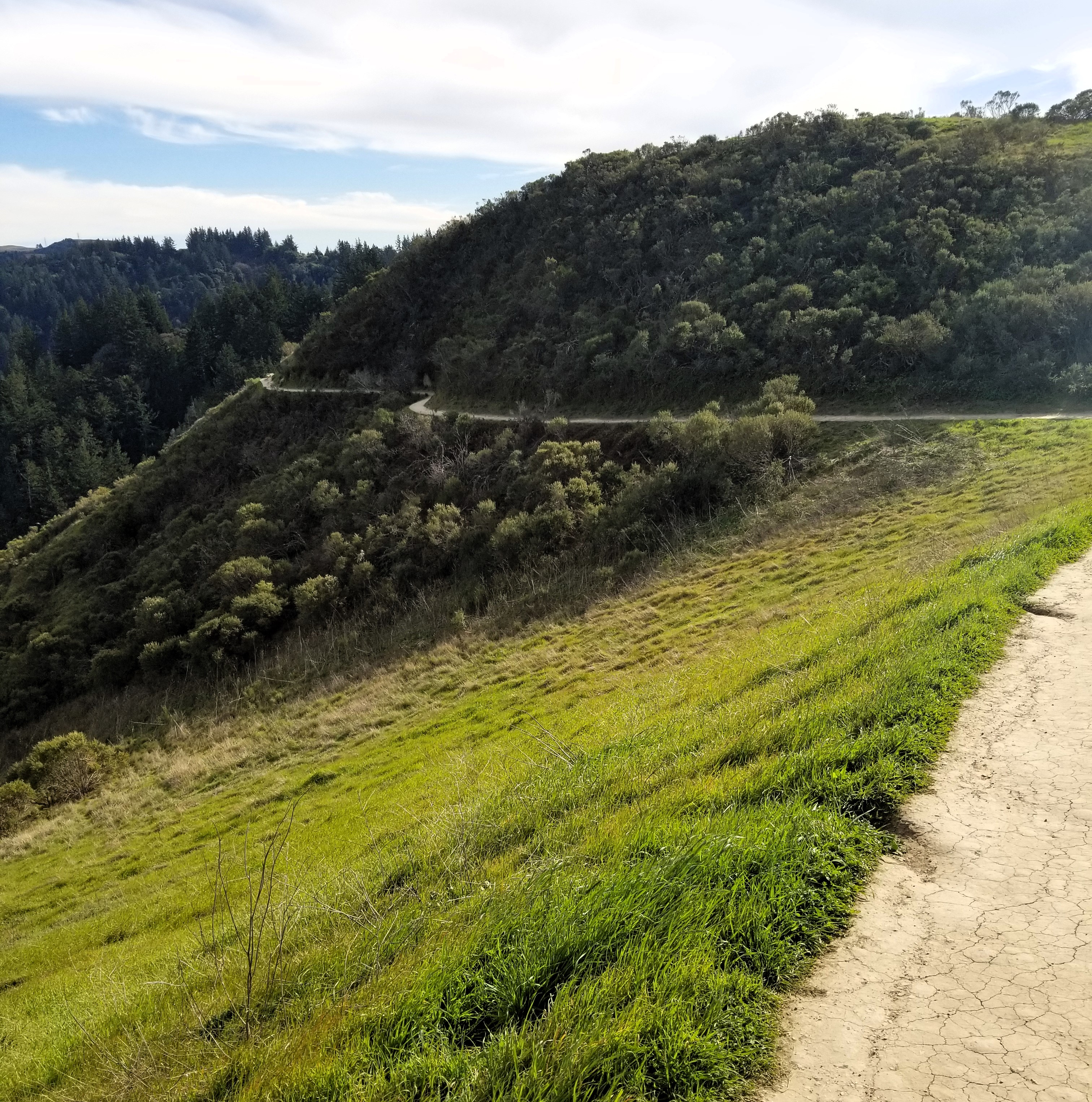
The route back.
The mystery compound across the valley.
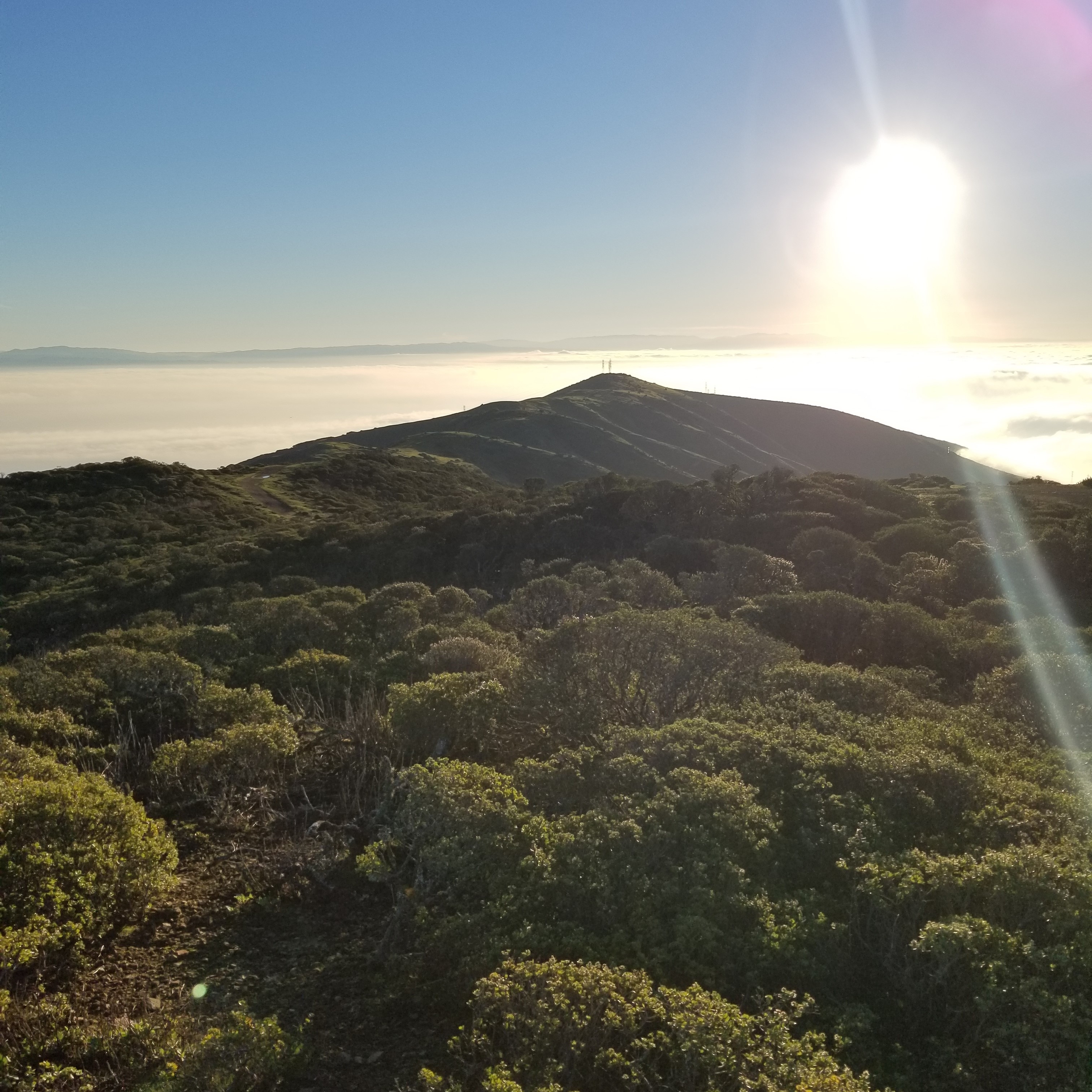
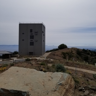
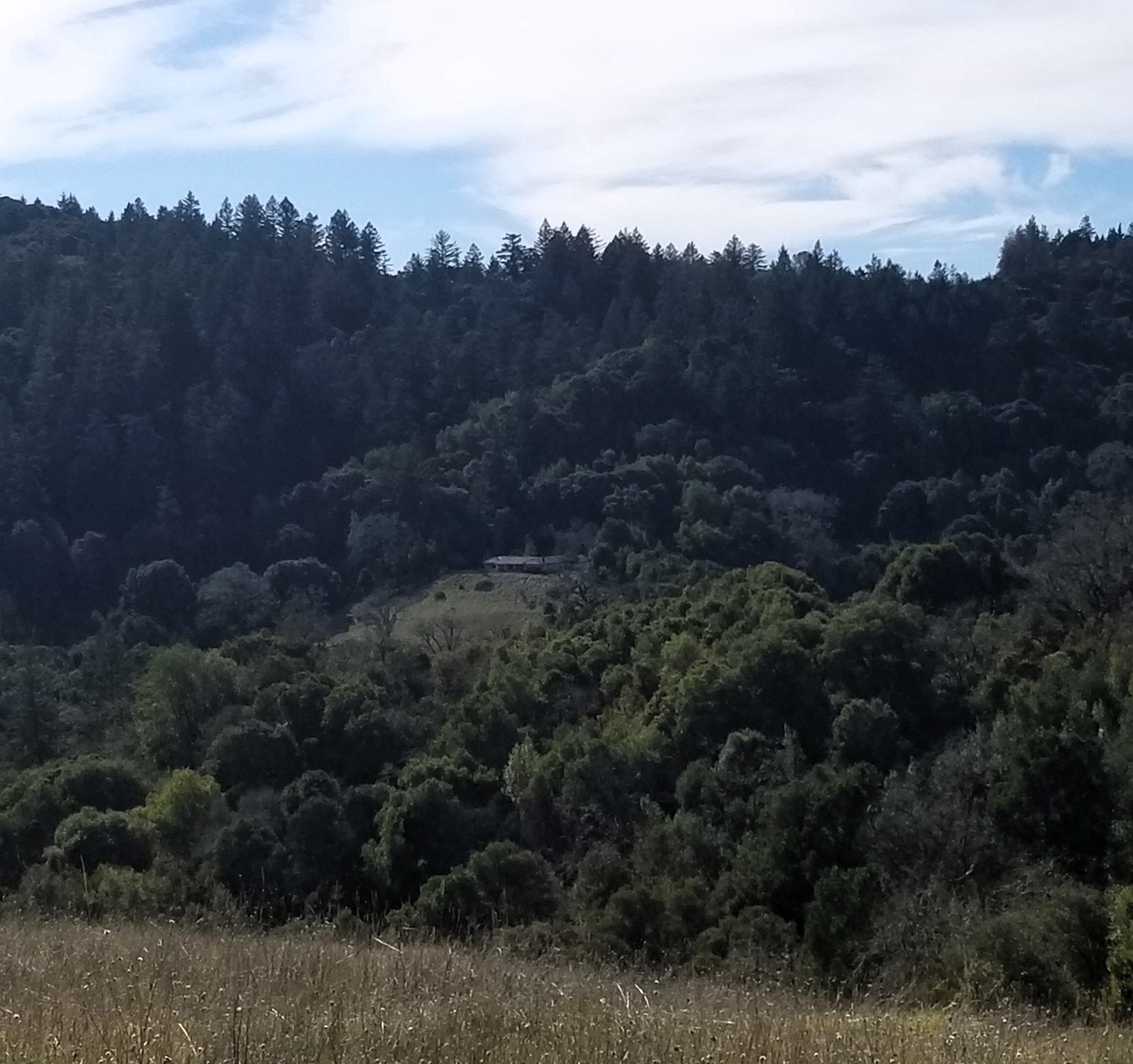
With about 1.5 miles to go, the Bella Vista Trail ends in a trail intersection that includes Montebello Road, the Adobe Creek Trail, and the Old Ranch Trail. From there and most of the way to the peak there's the option of taking the road or single-track. On the way up I choose the single track which looks out over the canyon (the namesake of the Canyon Trail). On the other side of the canyon are several open space parks and other things: Skyline Ridge, Monte Bello, Long Ridge, Upper Stevens Creek, as well as a Christmas tree farm, and a weird-looking large building that draws my attention. It’s surrounded by forest on three sides but to its front is a broad, grass step and a mostly cleared slope. It's as if it's squatting on the hillside, guarding over the valley. The building (compound?) is too far away to see any details, and I bemoan my short-sightedness in failing to bring the binoculars.
The trail dead ends into Monte Bello Road, about 1/4 mile from the peak itself. The road is a dirt and gravel access road that follows a ridge line going from Page Mill Road southeast to Black Mountain Peak and further. That final stretch to the peak is flat and passes ( the real reason for the road ) an accumulation of various types of radio towers and affiliated equipment ( which, for once, aren’t on the actual peak), and the peak arrives without drama.
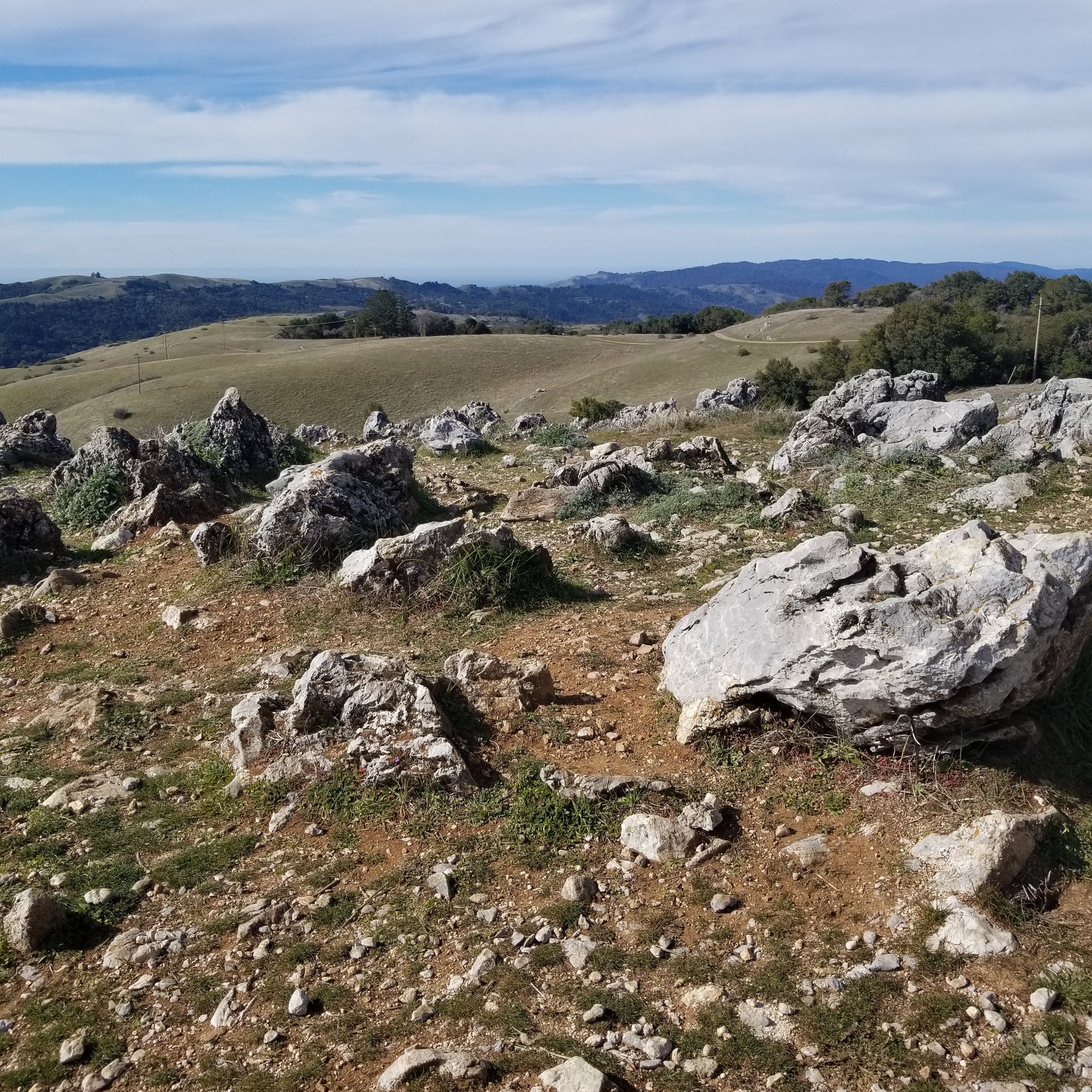
While most of the ground around is relatively smooth and stone free, the peak itself has a garden of jagged rocks poking through the surface. It feels like if we could just wash away all the dirt we'd have a magnificent and severe spire of sharp jagged rocks (on rereading that, I wonder if that statement isn't essentially true for most of the Earth). As I wandered amongst the rocks, searching for the USGS benchmark, one of the other people up there ( there were 3 others ), pointed out that these rocks all appear to be slanted at a similar angle. I wanted to explain how this happens and why, and, of course, what kind of rock it is, but I don't know, so instead asked if he’d take a photo. Which he does, and I look good. After finding the benchmark and taking a picture of it, because that's what one does, I headed out. On the way down I stayed on Montebello Road all the way to the Bella Vista trail. Compared to the single-track option there were fewer views and more bikes.
(Not) Borel Hill and Windy Hill
I headed to Borel Hill next, where, according to the information from Summitpost, there was a parking lot right off the road and next to the trailhead for the highpoint. It’s only about 1/2 mile hike, so that would be a quick tag. Black Mountain Peak was to be the only real hike of the day.
However, there's an issue. My car is down to 23 miles of range left worth of gas ( as my console display informs me. The accuracy of which, I have no clue ), and according to Google Maps, the nearest gas station is 16 miles. Not a very comforting cushion. The good news is that it should be mostly downhill to get to the gas station in Woodside. I decide to keep with the plan until or unless something pops up to change it. Something popped up. The roadside parking I was heading towards for Borel Hill is closed. Blocked off. Barricaded. My brief glance as I drove by gave me the impression that it was a casualty of COVID-prompted closures. I couldn't spend any of my last few miles of gas looking for other parking, so I went straight to Windy Hill.
I got to Windy Hill without a hitch, and it turned out not to be windy at all. The hike to the summit was only about a mile. The air was cool and some high clouds were blocking most of the sun. I made my way to the trail, with a brief stop at the information board to read about a badger study. Didn't even know there were badgers around here. That, of course, put me on high alert. Spoiler, I never saw a badger, but only a few feet into the hike something catches my eye in a meadow to the east of the trail. It was maybe two hundred feet away and tawny-colored. It wasn't close enough to see clearly but I wanted it to be a mountain lion ( or a badger but wrong color ). As I watched and saw it move around I came to believe it was probably a juvenile coyote. As I gently, slowly, delicately walked down the trail that looped around the other side of the meadow, a little closer to the creature, he saw me and dropped flat in the grass. Once he was hunkered down, I could see him even less than before so onward I went.
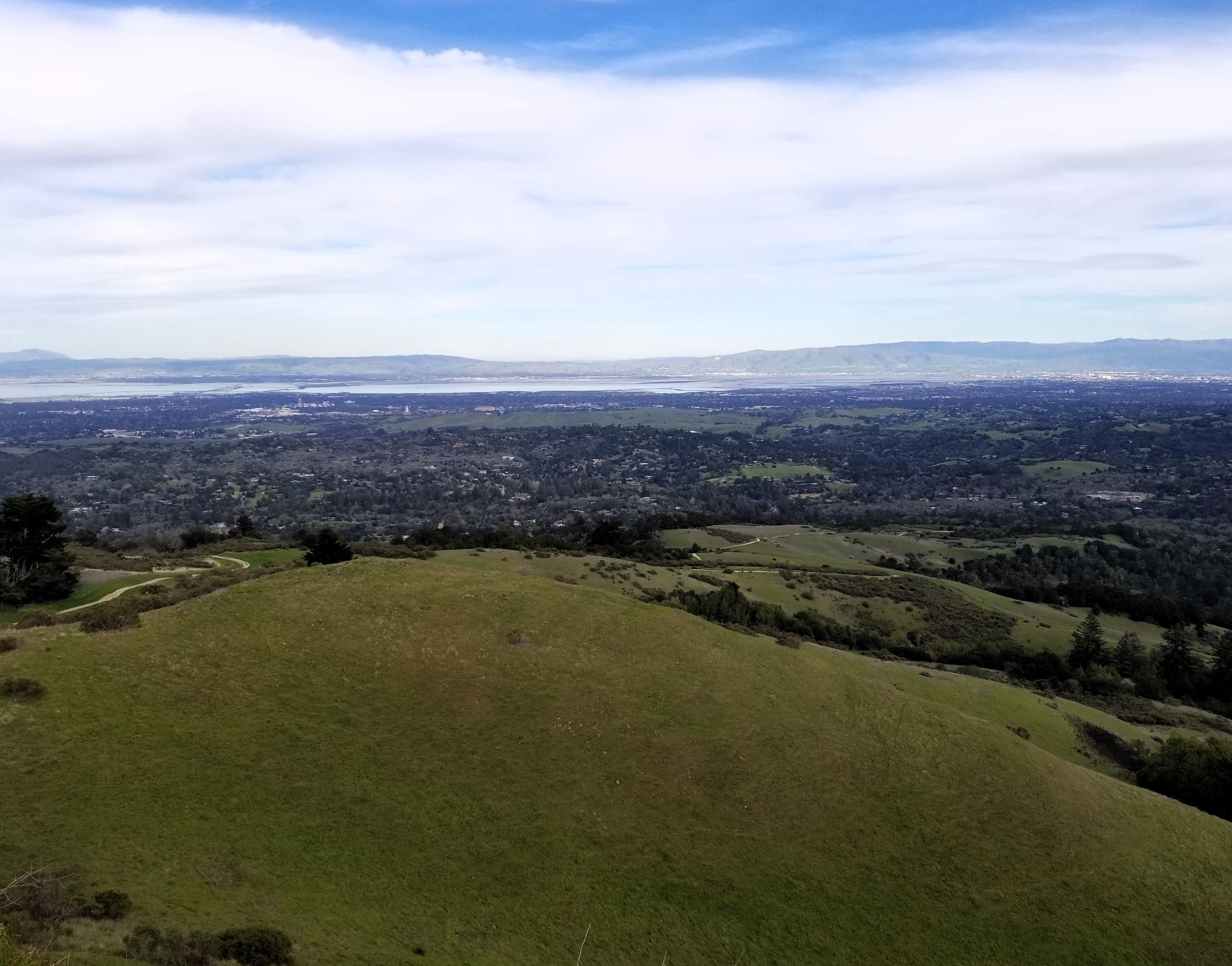
The view down into Windy Hill Preserve and the Valley.
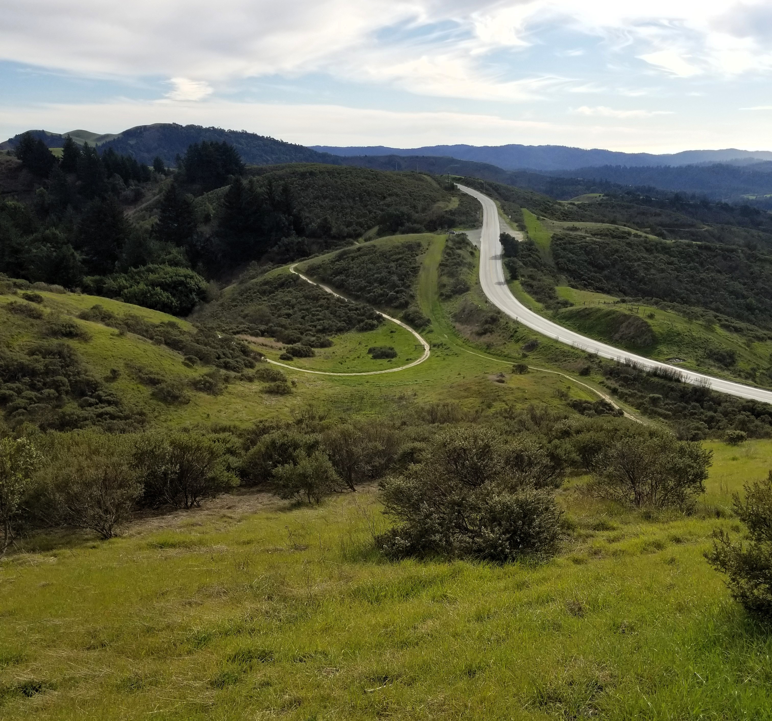
The road, the trail, the parkinglot, the coyote meadow..
It's a cool trail, if very short.
On to the peak, the trail contours around the east side of the hill giving a great view down into the rest of the Windy Hill preserve and the bay beyond. I made it to the top after a huge struggle ( not really, it's an easy half-mile), and found not one, but two benchmarks. I took pictures of both. There were also two other people on top. Two people, two benchmarks, coincidence!? It was a quick return jaunt back to the car, then I coaxed the thirsty car to a gas station.